BILS Area 5
A new employment precinct on Gulgan Road, planned alongside the wider Gulgan village.
What's been approved, what it means, and what's still ahead.

Image: Caringbah Vega Studios, Collins + Turner / John Gollings
What is BILS Area 5?
BILS Area 5 is a new employment precinct, planned as a home for local businesses. It sits on Gulgan Road between Brunswick Heads and Mullumbimby, beside the Pacific Motorway (M1). Around 6.5 hectares has been set aside as business and light-industrial land, with room for workshops, studios, trade premises, food and drink, specialised retail and other small-scale commercial uses, including space where owner-operators can live and work on the same site.
Byron is a shire of makers, trades and owner-operated businesses, the small operators who drive much of the local economy and are essential for our community. Unfortunately, many of them are being priced out of the area. BILS Area 5 is intended for exactly these businesses, with spaces flexible enough for a home office, a studio or a workshop, and room to establish and grow in the region they call home.
→ Explore the Planning Proposal
→ Read the FAQs
→ Ask us a question

The Broader Vision
Council identified the land as suitable for employment in its Business and Industrial Lands Strategy. Its environmental values were mapped before any layout was drawn. Development is kept to the paddocks already cleared for grazing, so the significant trees and remnant vegetation are largely retained, and the land around the precinct is held as conservation and rural landscape. The controls in the approved planning documents set how buildings sit, how tall they can be and how they are screened, so what follows suits the rural setting.
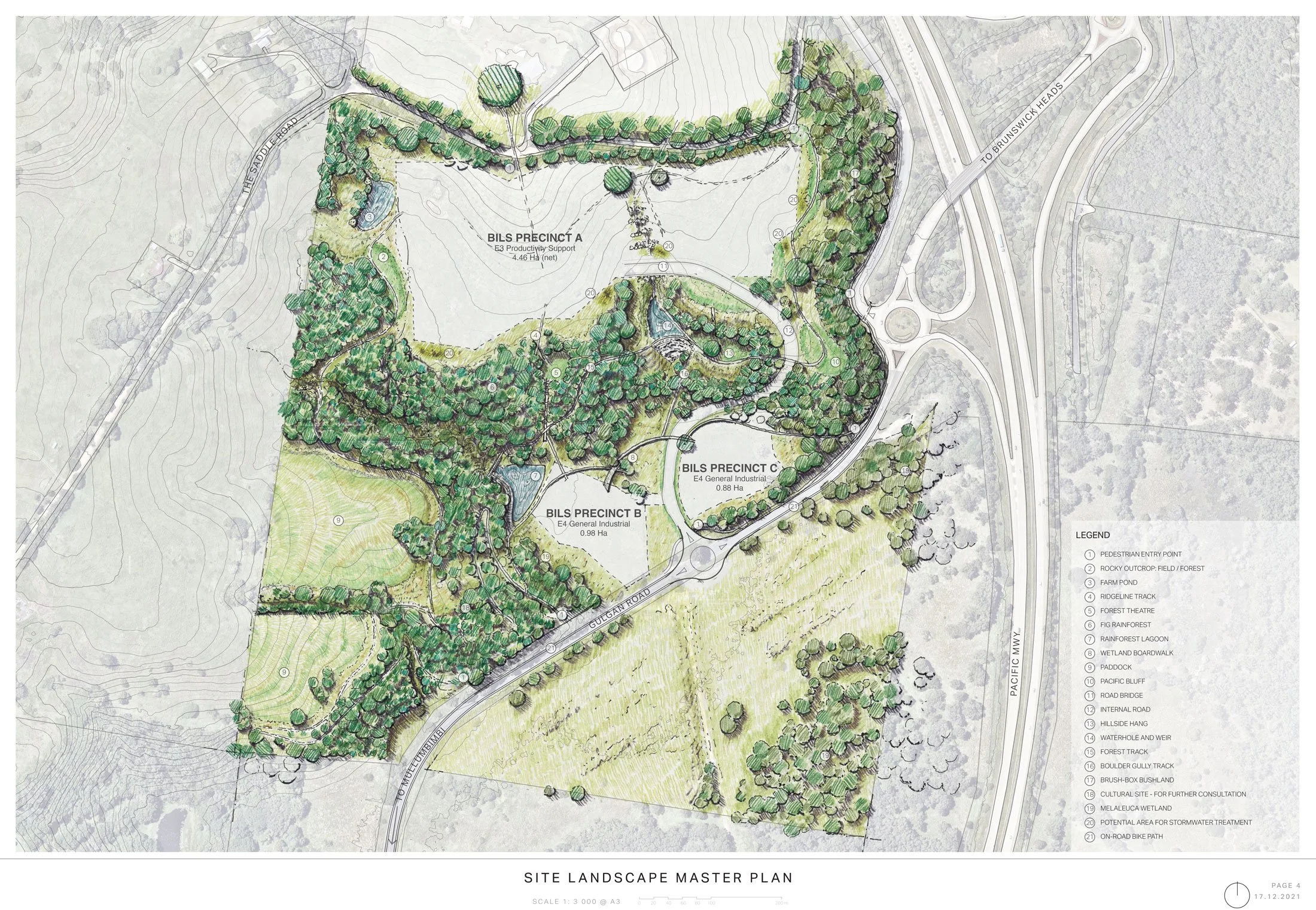
The approved Planning Proposal and Development Control Plan (Chapter E11), organise the precinct into three working areas, each with its own role: a business park that also allows work-live; and two areas for light industry and artisanal workshops. A fourth area holds the conservation and rural land around them.
BILS Area 5 has also been planned alongside Gulgan Village, a residential village proposed next door, as part of a broader vision for the area: jobs beside homes, so people can work close to where they live. Together they are intended as a genuine working village, rather than an isolated industrial estate set apart from the community.
Image: Anu Pop-Up Village, Craig Tan Architects
Images (below): A selection of reference images to help convey the scale, architectural language and material palette anticipated for the built form.


Where we're at
BILS Area 5 has been through its early planning stages: the land has been rezoned, the detailed controls (DCP) adopted, and a first subdivision approved. Together these set the planning framework the precinct will be developed within.
What does that actually mean? These approvals change the planning rules and set the standards any future development has to meet. They don't approve any building, road or construction. Anything built on the land still needs its own development application, lodged with and assessed by Council and placed on public exhibition, so there will be further chances for the community to see what's proposed and have a say. It's a real step, but the development applications, which are a planning stage in their own right, are still ahead.
This website is the home for current information about what has been decided and what it means, and it will be kept up to date as the precinct progresses.
What’s been approved
Three approvals are now in place. Here's a short summary of each, with fuller detail on its own page.
-
The Planning Proposal is the change to the rules for the land: it rezoned the site from rural to a mix of employment and conservation zones and set the controls, such as building heights and density. Gazetted on 30 May 2025 as Amendment No 47 to the Byron Local Environmental Plan 2014, it is now law. But changing the rules is not the same as approving a building, and any development here still needs its own application. More on the Planning Proposal page.
-
The DCP is the detailed rulebook beneath the LEP, guiding how the precinct is built, such as built form, subdivision, landscape and environmental management. Written specifically for BILS Area 5, it was adopted by Council on 16 April 2026 and took effect on 30 April 2026. It guides and controls; it doesn't approve roads, buildings or construction. More on the DCP page.
-
The 5-Lot Subdivision is the first division of the land into separate lots, approved in March 2026 with deferred commencement conditions. It's an early step in laying things out, creating five individual land parcels, including a lot for not-for-profit group homes delivered by Byron Shire Community Housing. More on the Subdivision page.
Location
Address
66 The Saddle Road, Brunswick Heads, NSW 2483
Lot / Plan
Part Lot 2 in DP 1159910
Site Area
52 hectares
Employment Land
6.5 hectares (approx)
Zones
E3 Productivity Support · E4 General Industrial · RU2 Rural Landscape · C2 Environmental Conservation · C3 Environmental Management
The site sits in the north of the Byron Shire, on elevated land just west of the Pacific Motorway (M1), reached directly from Gulgan Road. It has good motorway access for the businesses that will be based here, and the towns where people currently live are only a few minutes away:
Brunswick Heads — about 6 minutes
Mullumbimby — about 9 minutes
Byron Bay — about 16 minutes
Ballina Byron Gateway Airport — about 30 minutes
Immediately to the north is Gulgan Village, the residential village planned alongside it
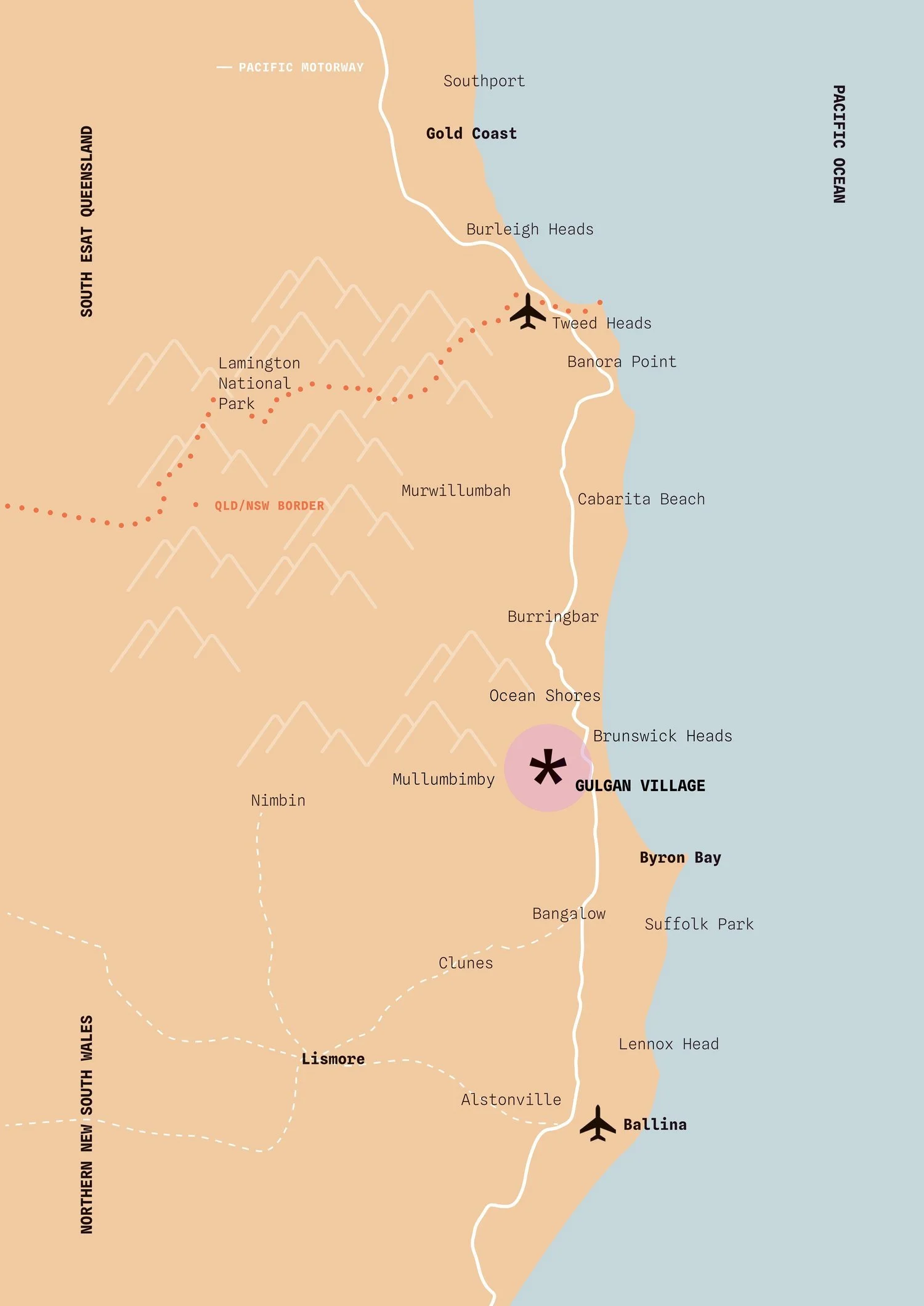
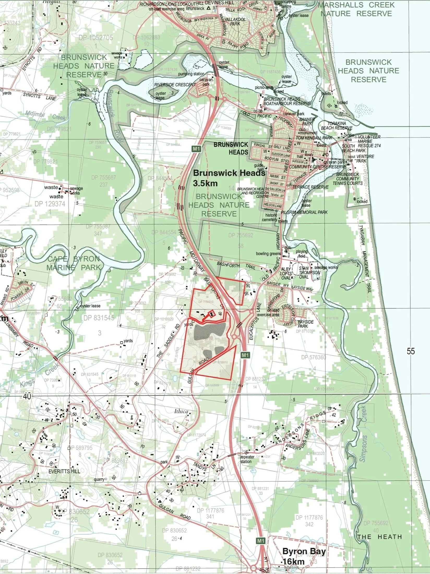
Map 1: Regional context. Map 2: Lot 2 DP 1159910 relative to the M1 Pacific Highway, Brunswick Heads and Mullumbimby. BILS Area 5 is highlighted in light grey.
The Site
The land is gently sloping, cleared and degraded former farmland: low-value grazing with rocky basalt outcrops and open rural outlooks. The layout follows the land. The light industry sits on the lower, flatter ground, with direct access off Gulgan Road where heavier vehicles belong. The business park and work-live spaces sit higher up on the gently undulating ground, reached by a new public collector road and kept to a smaller footprint that suits the topography. The steeper, more vegetated land around the precinct stays as conservation and rural landscape.
The planning behind it is backed by independent studies of the site's ecology, bushfire, flooding, traffic, contamination and agriculture, among others. They shaped where development sits and how it is controlled, and there's a short summary of each on the Planning Proposal page.
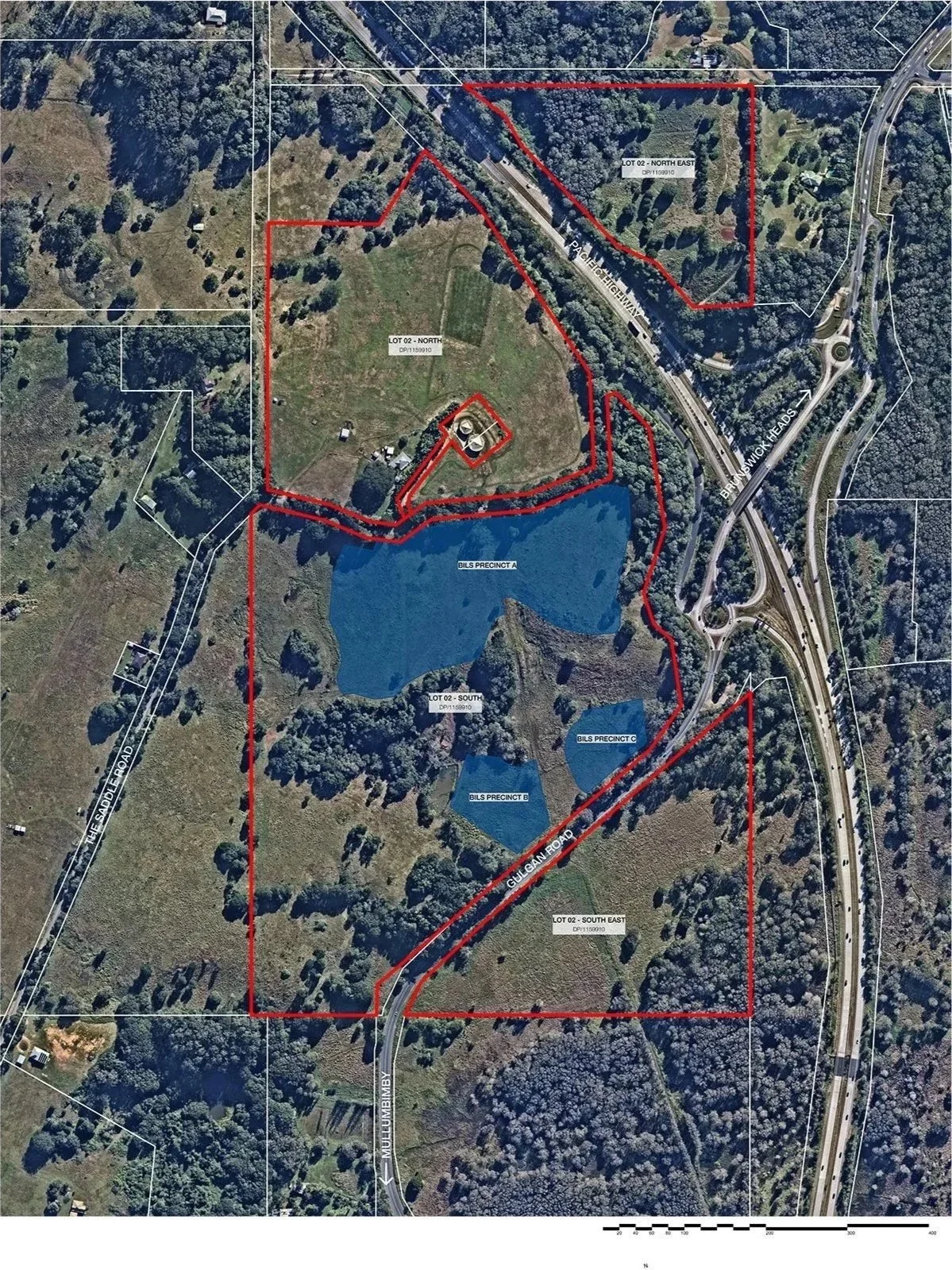

Map 1: Aerial image of the site with boundaries shown in red. The BILS Area 5 precincts are highlighted in blue. Map 2: land identified as Area 5 in Council’s Business and Industrial Lands Strategy.
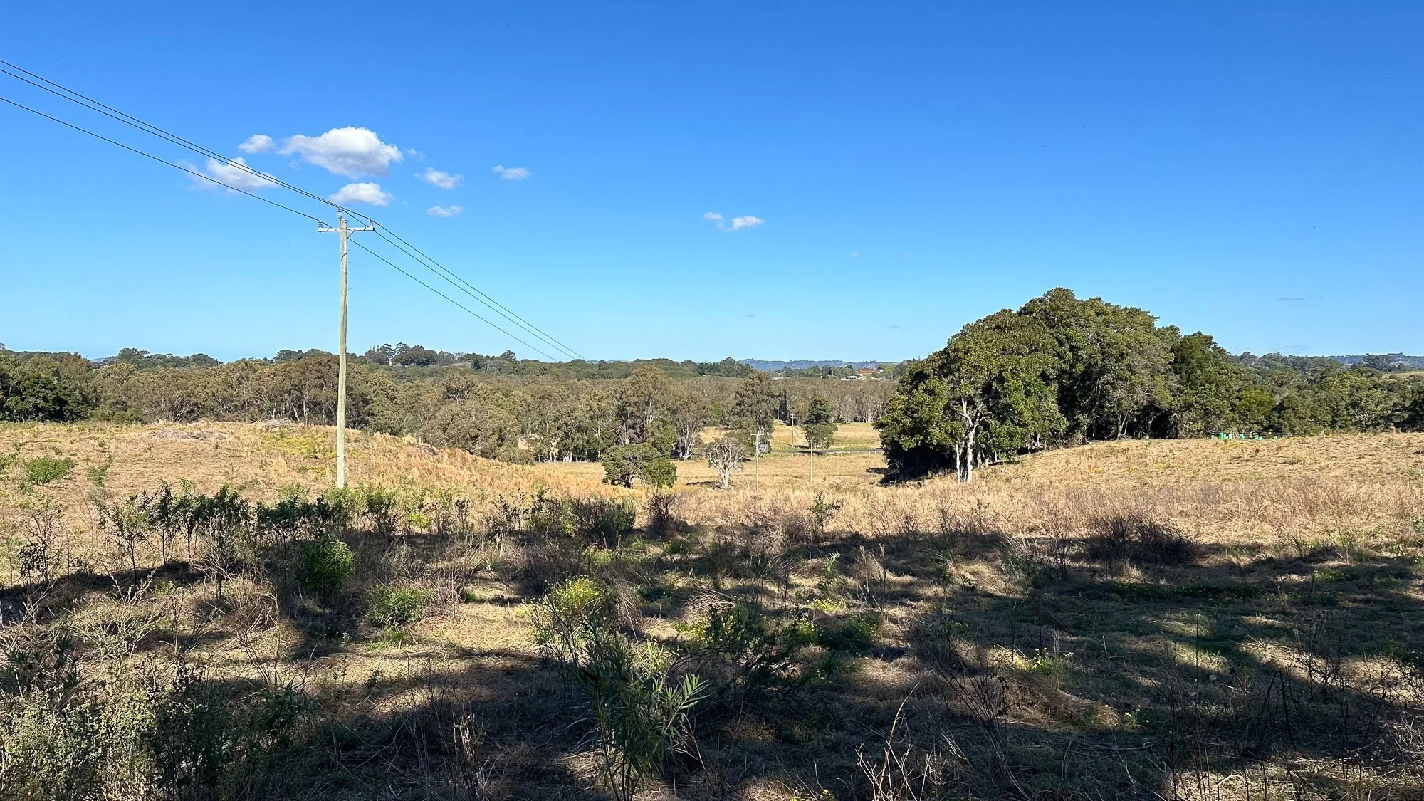
Images (below): A selection of images from the site showing its current condition.
-
![Open field with grass and trees, blue sky, and a signboard advertising a beach 5 minutes away.]()
Gulgan Road - Looking north
-
![Open field with trees, a metal roller shade, and a distant view of the ocean under a clear blue sky.]()
Precinct A - Looking east
-
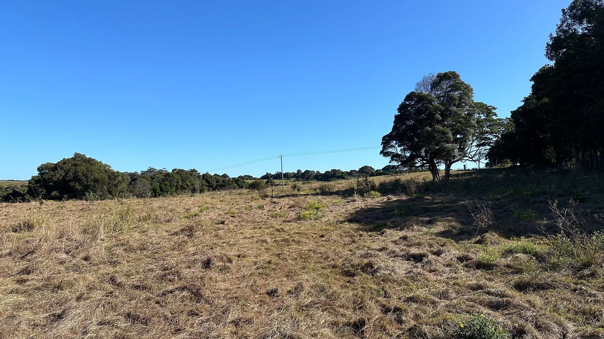
![Open field with dry grass and scattered trees, power lines running across the sky, under a clear blue sky with a few small clouds.]()
Precinct A - Looking south to Gulgan Road
-
![A wide landscape view of a field with dry grass, scattered bushes, and some trees on the right, under a clear blue sky. Power lines run across the scene in the background.]()
Precinct A - Looking west
-
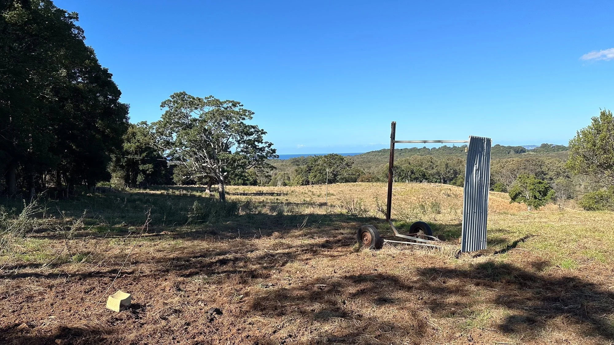
![A rural landscape with trees, grassy fields, and a view of the ocean in the distance under a blue sky, with some equipment and a weathered metal structure in the foreground.]()
Precinct A - Looking east
-
![A grassy field with tall grass and wildflowers, bordered by trees and hills under a clear blue sky.]()
Precinct B - Looking north
-
![A rural landscape with trees, grassy fields, and a clear blue sky.]()
Precinct B+C - Looking southwest
-
![Open grassy field with scattered trees and power lines against a bright blue sky with small clouds.]()
Precinct C (left) - Looking south to Gulgan Road
-
![A grassy field extending to a wooded area with tall trees and a clear blue sky overhead.]()
Precinct C - Looking east
-
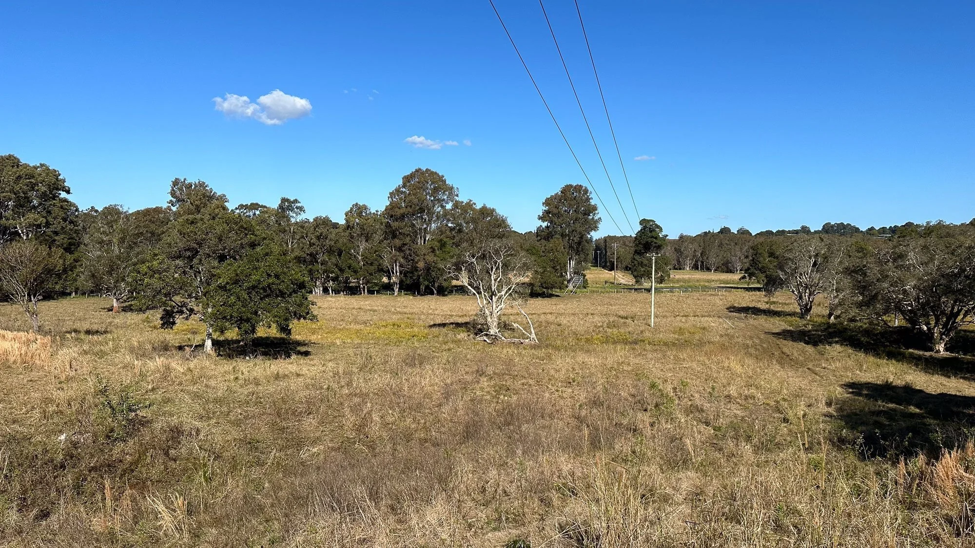
![Open field with grass, scattered trees, and a hillside with power lines and poles under a clear blue sky.]()
Precinct C - Looking northeast
-
![Open field with tall grass, scattered trees, utility poles, and power lines under a bright blue sky with a few white clouds.]()
Precinct C - Looking Looking south to Gulgan Road
-
![Rocky terrain with large rocks and sparse green vegetation, surrounded by trees under a clear blue sky.]()
Basalt boulders - Typical across the site
-
![A detailed site landscape master plan showing various designated areas, pathways, roads, and natural features with labels and a legend for reference.]()
Landscaping Plan


The Team
BILS Area 5 has been developed by Byron-based team Creative Capital, with specialist consultants advising on every aspect of the precinct.
Creative Capital
Development managers
Planners North
Town planning advice
Balanced Planning
Town planning advice
Simpson & Wilson
Architecture & urban design
INGEN Consulting
Civil and traffic engineering advice
Australian Bushfire Consulting Group
Bushfire planning
Bower Ecology
Biodiversity and ecology
Across The Line Consulting
Environmental science and community consultation
Landscape Workshop
Landscape architecture
John Allen & Associates
Agricultural capability
Tim Fitzroy & Associates
Land-use conflict
Contaminated Site Investigation Australia
site assessment
Everick Heritage
Cultural heritage
Timeline