Planning Proposal
What the Planning Proposal is, what it changed, and what that does and doesn't mean for the land.
What is a Planning Proposal?
A Planning Proposal is the formal way to change the planning rules for a piece of land. In New South Wales, what you can do with a site, and the limits that apply, are set out in a council's Local Environmental Plan (LEP), the legal document that governs land use across the local area. To allow something the current rules don't, the LEP has to be amended, and the request to do that is a Planning Proposal.
For BILS Area 5, that step is complete. The proposal was gazetted on 30 May 2025 as Amendment No 47 to the Byron Local Environmental Plan 2014, so the new rules are now law. It rezoned the land from rural to a mix of employment and conservation zones, and set the controls for how it can be developed.
Changing the rules is not the same as approving a building. The amendment sets what is possible here and the standards any development will have to meet; it does not approve any particular development. Anything built on the land still needs its own development application, assessed by Council and placed on public exhibition, with further chances for the community to have a say.
What changed?
The amendment rezoned the land and set new controls for the employment precinct.
In summary:

Greenhouse, Joost Backker
Control
Before
Now
Zoning
Predominantly RU2 Rural Landscape, with some existing C2 + C3 conservation land
A mix of E3 Productivity Support, E4 General Industrial, and substantially more C2 Environmental Conservation + C3 Environmental Management zoning, with some RU2 Rural Landscape retained
Local Clause
na
a work-live clause in Precinct A
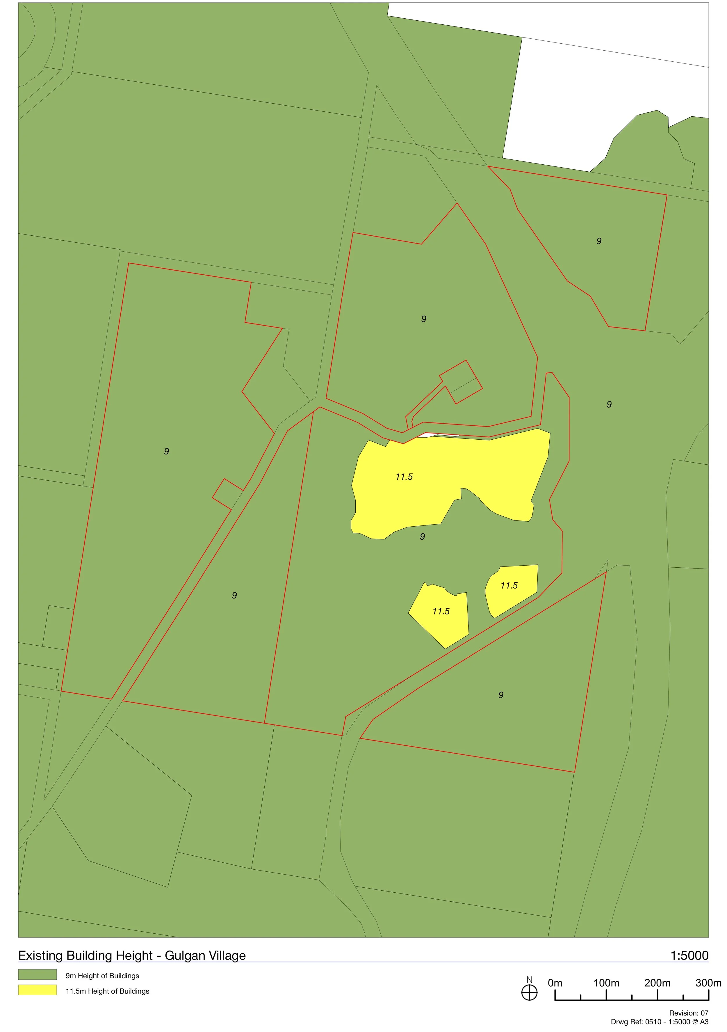
Building height
no employment height control
11.5 m
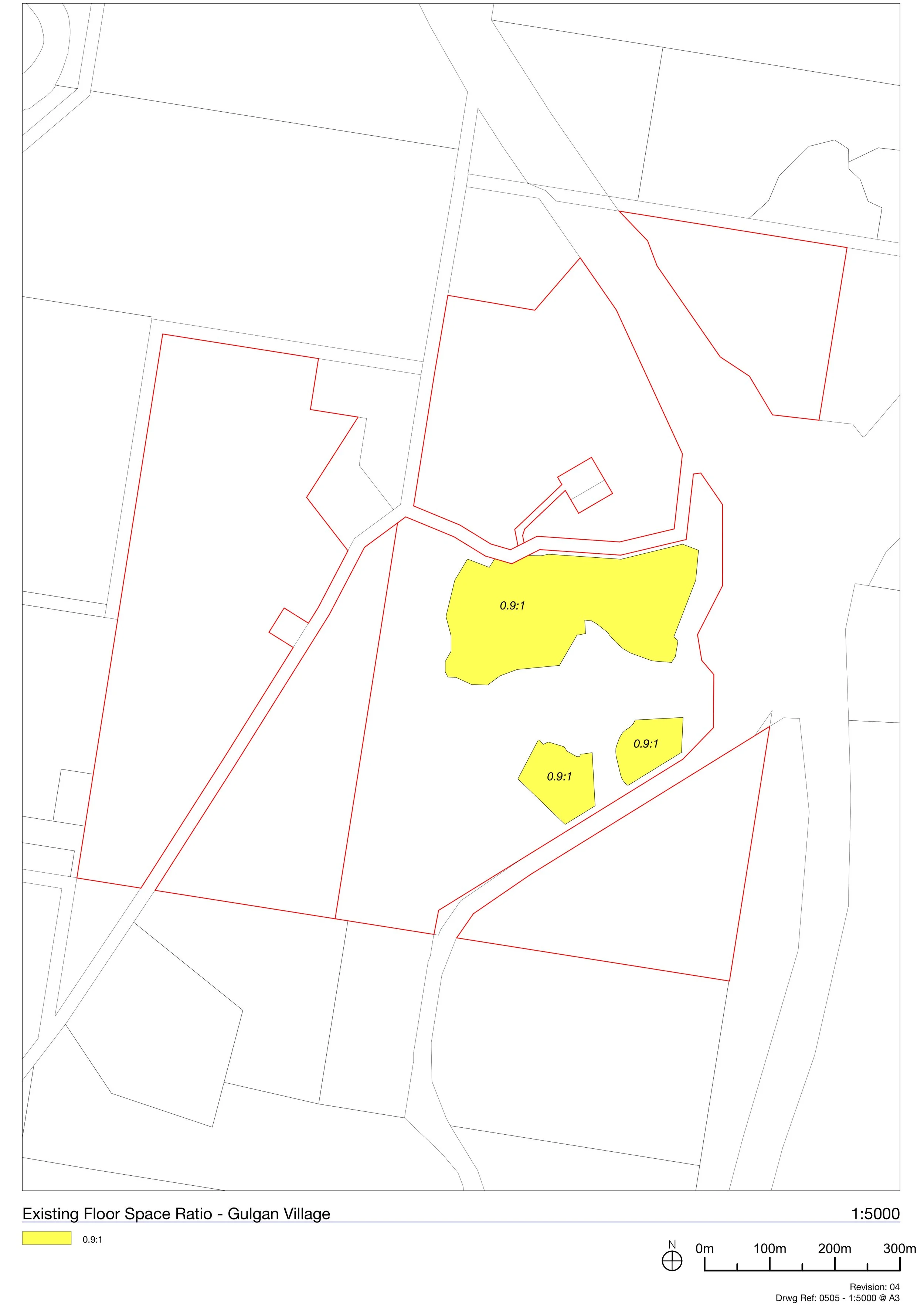
Floor space ratio
none
0.9 : 1
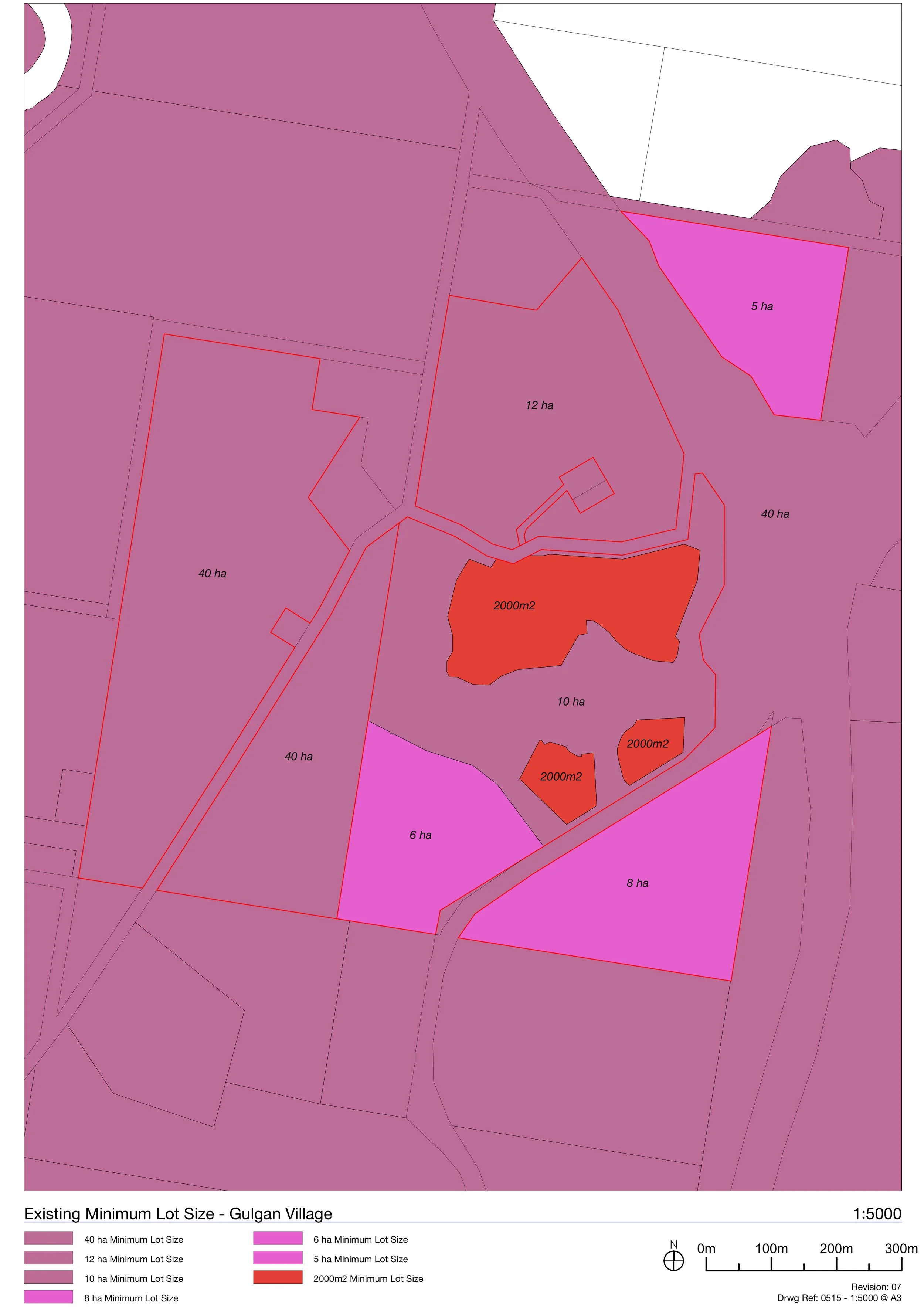
Minimum lot size
large rural lots
2,000 m² for the employment lots
Road access
—
a clause protecting safe movement on Gulgan Road
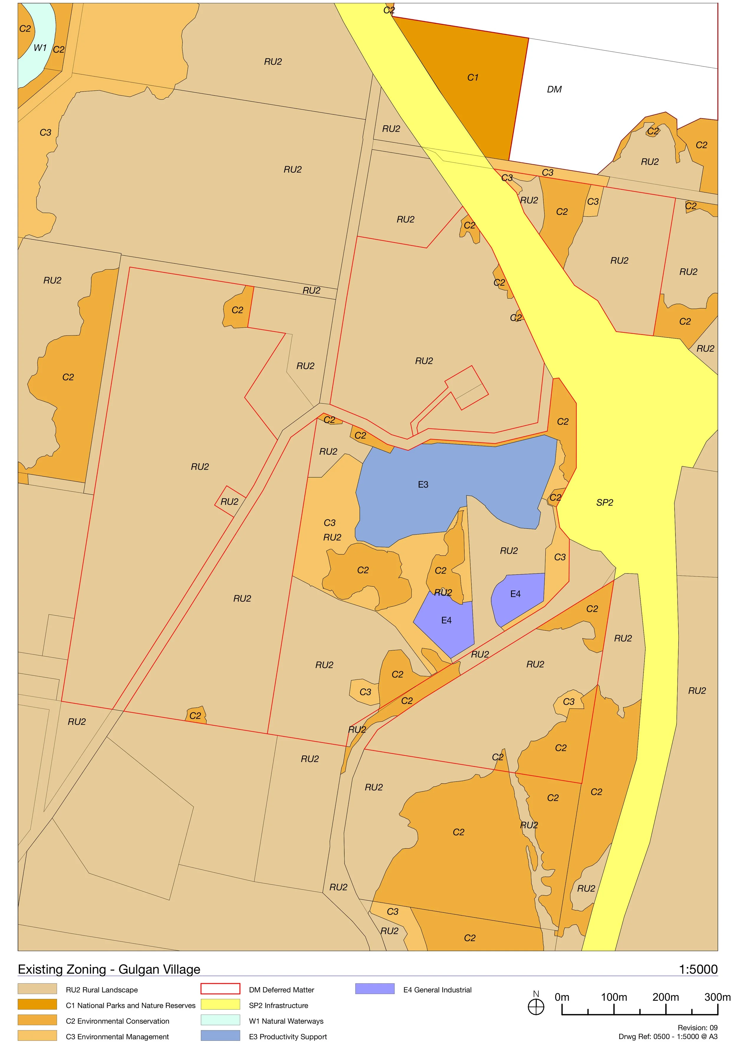
The rezoning covers a little over 7 hectares. A public road runs through Precinct A, so once that is set aside, the net employment land is around 6.5 hectares, the figure identified for this site in Council's Business and Industrial Lands Strategy.
The amendment also substantially extended the land set aside for conservation and environmental management beyond the C2 and C3 zoning already there.
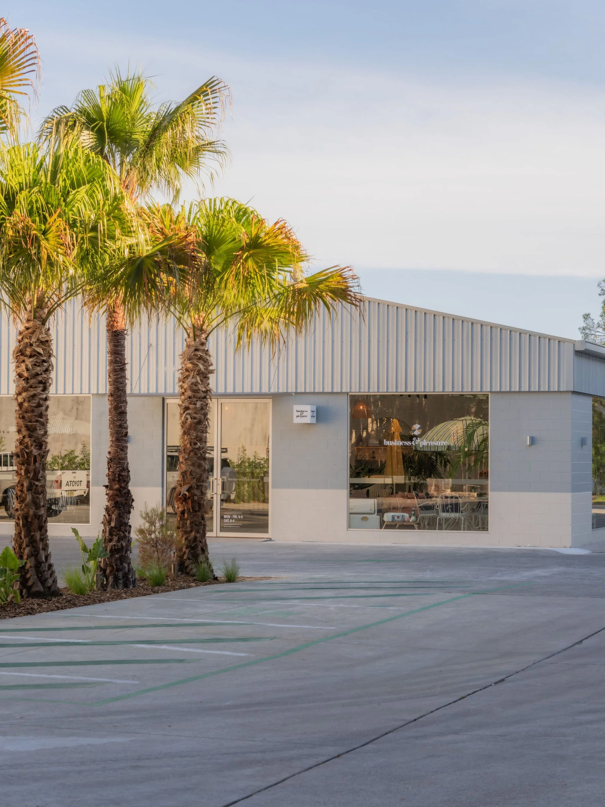
Image: 16 Banksia Drive, Occupy Studio (Scott Wilson)
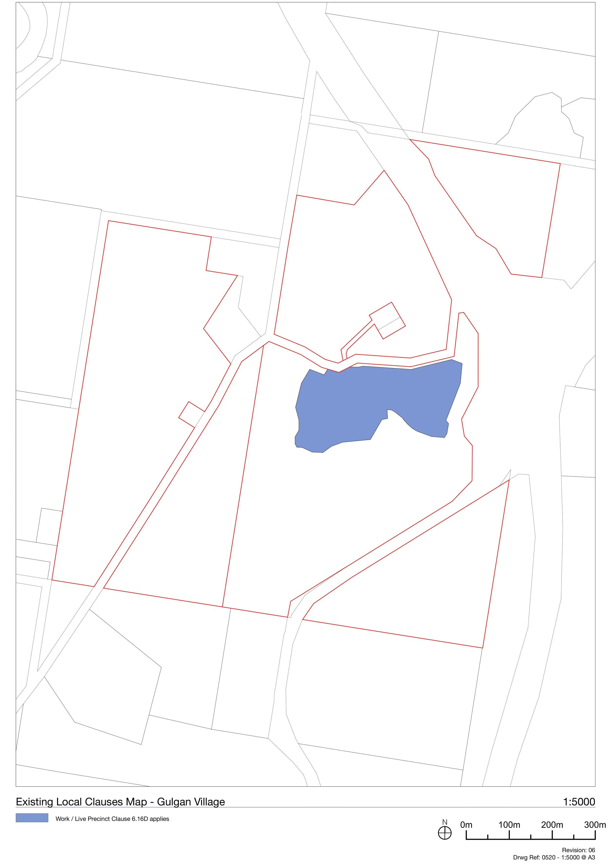
The Precincts
The land is organised into three working precincts, each with its own role, plus a fourth that holds the conservation and rural land around them. They're shown on the Precinct Plan opposite and set out in full in the Development Control Plan (see the DCP page). Below is a brief introduction to each.
Precinct A: Productivity Support (E3). The business park, on the higher, gently rising ground, reached by a new public collector road. The most flexible part of the site: offices, creative and small-scale enterprises, training and education uses, and work-live space where an owner-operator can run a business and live on site.
Precinct B: General Industrial (E4). On the lower, flatter ground: smaller artisanal workshops and makerspaces with shared facilities, the kind of flexible, fine-grained space that's hard to find in the Shire.
Precinct C: General Industrial (E4). Also on the lower ground, with direct access off Gulgan Road where larger vehicles and loading belong: more conventional light industry and trade space, the practical kind that usually ends up well out of town.
Precinct D: Conservation and rural land. The land around the working precincts, zoned C2 Environmental Conservation, C3 Environmental Management and RU2 Rural Landscape, held and managed for the long term.
Map: Precinct Plan
The Studies behind the Proposal


The proposal is backed by a suite of independent technical studies that tested the site's conditions and shaped the response. The full reports form part of the planning record and can be viewed here.In summary:
Ecology
The site's vegetation and habitat were mapped first, and the precincts placed on land already cleared for grazing, away from the better native vegetation. The assessment found significant ecological impacts unlikely and proposes revegetation and additional conservation land to improve habitat over time. Further work follows at the development stage.
Agriculture
A land-capability assessment found the site is poor grazing country, around 80% of it in the lowest agricultural class, held back by steep slopes, shallow soils and rock. Rezoning it would not meaningfully affect the region's farming.
Contamination
Soil testing across the land came back clean, confirming it's suitable for its intended use, with one exception covered separately below.
The former cattle dip
Testing of the old cattle dip found the contamination hadn't spread far, with none detected ten metres out. A precautionary fenced buffer of about fifteen metres is kept around it, and the rest of the site is cleared for use.
Land-use conflict
A land-use conflict assessment rated every potential conflict with neighbouring rural activity as low and acceptable, helped by generous separation: the nearest dwelling is about 174 metres away, screened by the lie of the land.
Riparian and water
The drainage lines across the site were mapped and assessed against the State's waterway rules. The minor ones on the developable land can be managed, while the more significant waterways sit within the conservation zones.
Aboriginal cultural heritage
A cultural induction with the local Aboriginal community is required before any ground is disturbed, and Aboriginal cultural heritage will be respected in how the land is developed and managed.
Bushfire
The land is bushfire-prone, like much of the Shire, so a bushfire assessment was prepared. It found the required measures, such as asset-protection zones and access, can be provided largely within the development precincts and to the NSW Planning for Bushfire Protection standard, with the detail resolved at each development stage.
Flooding
Flood mapping prepared to the State's requirements found the developable land sits above the main flood hazard, which falls on the drainage lines and lower ground the precincts are kept clear of. The lowest ground will be raised to a safe level.
Traffic
Prepared with Transport for NSW, the traffic study found the precinct can be served safely by a single access off Gulgan Road, with most trips heading north toward Brunswick Heads. It also noted the nearby Mullumbimby Road intersection needs upgrading regardless of this proposal, and a planned roundabout addresses it.
Engineering and servicing
The civil assessment found the precinct can be serviced: water from the existing Saddle Road reservoirs, sewer pumped to the Brunswick Heads network, and stormwater detained and treated on site so the development doesn't worsen downstream flows.
The Voluntary Planning Agreement
Alongside the rezoning sits a Voluntary Planning Agreement (VPA), an agreement with Byron Shire Council. It has been executed and registered on the land title, so its commitments run with the land.
Under it, the developer will deliver, at its own cost, a staged upgrade of the Gulgan Road frontage: first a left-in, left-out intersection at the site entry, then a roundabout at the entrance, and later a southbound bypass lane. Each stage is built as the precinct reaches it, and handed to Council once complete.
The point of the agreement is straightforward: safer, more accessible road access for the precinct and for everyone using Gulgan Road, paid for by the development rather than the wider community.